(Q545785)
بيانات
Wikidata item الإنجليزية
owned by الإنجليزية
maintained by الإنجليزية
Commons category الإنجليزية
instance of الإنجليزية
country الإنجليزية
KML file الإنجليزية
terminus الإنجليزية
road number الإنجليزية
part of الإنجليزية
length الإنجليزية
inception الإنجليزية
١٧ نوفمبر 1963http://data.marefa.org/entity/Q1985727
reason for preferred rank الإنجليزية
١ مراجع
Imported from Wikidata item الإنجليزية
partially coincident with الإنجليزية
Freebase ID الإنجليزية
connects with الإنجليزية
Interstate 295 الإنجليزية
location الإنجليزية
National Harbor الإنجليزية
coordinate location الإنجليزية
38°47'42.7"N, 77°0'55.1"W
١ مراجع
Imported from Wikidata item الإنجليزية
Maryland Route 210 الإنجليزية
coordinate location الإنجليزية
38°48'11.56"N, 76°59'56.08"W
١ مراجع
Imported from Wikidata item الإنجليزية
Maryland Route 414 الإنجليزية
coordinate location الإنجليزية
38°48'31.0"N, 76°58'14.2"W
١ مراجع
Imported from Wikidata item الإنجليزية
Maryland Route 5 الإنجليزية
location الإنجليزية
coordinate location الإنجليزية
38°49'10.6"N, 76°55'9.5"W
١ مراجع
Imported from Wikidata item الإنجليزية
Maryland Route 4 الإنجليزية
location الإنجليزية
Westphalia الإنجليزية
coordinate location الإنجليزية
38°50'23.42"N, 76°52'0.19"W
١ مراجع
Imported from Wikidata item الإنجليزية
Maryland Route 214 الإنجليزية
location الإنجليزية
coordinate location الإنجليزية
38°53'31.88"N, 76°50'49.63"W
١ مراجع
Imported from Wikidata item الإنجليزية
Maryland Route 202 الإنجليزية
location الإنجليزية
coordinate location الإنجليزية
38°55'2.24"N, 76°51'6.01"W
١ مراجع
Imported from Wikidata item الإنجليزية
U.S. Route 50 in Maryland الإنجليزية
coordinate location الإنجليزية
38°56'43.69"N, 76°51'29.88"W
١ مراجع
Imported from Wikidata item الإنجليزية
Interstate 595 (Maryland) الإنجليزية
coordinate location الإنجليزية
38°56'43.69"N, 76°51'29.88"W
١ مراجع
Imported from Wikidata item الإنجليزية
Maryland Route 450 الإنجليزية
coordinate location الإنجليزية
38°57'34.27"N, 76°51'58.10"W
١ مراجع
Imported from Wikidata item الإنجليزية
Baltimore–Washington Parkway الإنجليزية
coordinate location الإنجليزية
38°59'29.69"N, 76°53'9.38"W
١ مراجع
Imported from Wikidata item الإنجليزية
Maryland Route 201 الإنجليزية
coordinate location الإنجليزية
39°0'10.1"N, 76°53'42.7"W
١ مراجع
Imported from Wikidata item الإنجليزية
U.S. Route 1 in Maryland الإنجليزية
location الإنجليزية
coordinate location الإنجليزية
39°1'5.81"N, 76°55'35.33"W
١ مراجع
Imported from Wikidata item الإنجليزية
location الإنجليزية
coordinate location الإنجليزية
39°1'16.0"N, 76°57'4.3"W
١ مراجع
Imported from Wikidata item الإنجليزية
Maryland Route 212 الإنجليزية
location الإنجليزية
coordinate location الإنجليزية
39°3'3.02"N, 76°55'47.86"W
١ مراجع
Imported from Wikidata item الإنجليزية
Maryland Route 200 الإنجليزية
coordinate location الإنجليزية
39°4'24.78"N, 76°54'19.12"W
١ مراجع
Imported from Wikidata item الإنجليزية
Maryland Route 198 الإنجليزية
coordinate location الإنجليزية
39°5'59.46"N, 76°53'23.10"W
١ مراجع
Imported from Wikidata item الإنجليزية
Maryland Route 216 الإنجليزية
location الإنجليزية
coordinate location الإنجليزية
39°7'45.95"N, 76°51'44.35"W
١ مراجع
Imported from Wikidata item الإنجليزية
Maryland Route 32 الإنجليزية
coordinate location الإنجليزية
39°9'28.19"N, 76°49'29.78"W
١ مراجع
Imported from Wikidata item الإنجليزية
Maryland Route 175 الإنجليزية
location الإنجليزية
coordinate location الإنجليزية
39°10'39.68"N, 76°47'22.06"W
١ مراجع
Imported from Wikidata item الإنجليزية
Maryland Route 100 الإنجليزية
location الإنجليزية
coordinate location الإنجليزية
39°11'48.34"N, 76°45'57.92"W
١ مراجع
Imported from Wikidata item الإنجليزية
Interstate 895 الإنجليزية
location الإنجليزية
coordinate location الإنجليزية
39°13'20.03"N, 76°43'15.56"W
١ مراجع
Imported from Wikidata item الإنجليزية
Maryland Route 166 الإنجليزية
location الإنجليزية
coordinate location الإنجليزية
39°14'7.51"N, 76°42'36.18"W
١ مراجع
Imported from Wikidata item الإنجليزية
Interstate 195 الإنجليزية
location الإنجليزية
coordinate location الإنجليزية
39°14'7.51"N, 76°42'36.18"W
١ مراجع
Imported from Wikidata item الإنجليزية
Interstate 695 الإنجليزية
location الإنجليزية
coordinate location الإنجليزية
39°15'2.5"N, 76°40'47.6"W
١ مراجع
Imported from Wikidata item الإنجليزية
U.S. Route 1 Alternate الإنجليزية
location الإنجليزية
coordinate location الإنجليزية
39°15'56.5"N, 76°40'1.2"W
١ مراجع
Imported from Wikidata item الإنجليزية
Baltimore–Washington Parkway الإنجليزية
location الإنجليزية
coordinate location الإنجليزية
39°16'9.44"N, 76°38'0.60"W
١ مراجع
Imported from Wikidata item الإنجليزية
Interstate 395 الإنجليزية
location الإنجليزية
coordinate location الإنجليزية
39°16'3.0"N, 76°37'27.1"W
١ مراجع
Imported from Wikidata item الإنجليزية
Maryland Route 2 الإنجليزية
location الإنجليزية
coordinate location الإنجليزية
39°16'0.73"N, 76°36'53.42"W
١ مراجع
Imported from Wikidata item الإنجليزية
Maryland Route 150 الإنجليزية
location الإنجليزية
coordinate location الإنجليزية
39°17'16.62"N, 76°31'59.95"W
١ مراجع
Imported from Wikidata item الإنجليزية
U.S. Route 40 in Maryland الإنجليزية
location الإنجليزية
coordinate location الإنجليزية
39°18'32.62"N, 76°31'54.05"W
١ مراجع
Imported from Wikidata item الإنجليزية
Interstate 895 الإنجليزية
location الإنجليزية
coordinate location الإنجليزية
39°19'9.26"N, 76°32'0.13"W
١ مراجع
Imported from Wikidata item الإنجليزية
Interstate 695 الإنجليزية
location الإنجليزية
coordinate location الإنجليزية
39°21'4.75"N, 76°29'47.44"W
١ مراجع
Imported from Wikidata item الإنجليزية
Maryland Route 43 الإنجليزية
location الإنجليزية
coordinate location الإنجليزية
39°22'45.55"N, 76°26'57.34"W
١ مراجع
Imported from Wikidata item الإنجليزية
Maryland Route 152 الإنجليزية
location الإنجليزية
Joppatowne الإنجليزية
coordinate location الإنجليزية
39°26'31.27"N, 76°20'54.78"W
١ مراجع
Imported from Wikidata item الإنجليزية
Maryland Route 24 الإنجليزية
location الإنجليزية
coordinate location الإنجليزية
39°27'24.70"N, 76°18'36.25"W
١ مراجع
Imported from Wikidata item الإنجليزية
Maryland Route 543 الإنجليزية
location الإنجليزية
coordinate location الإنجليزية
39°29'2.87"N, 76°15'4.97"W
١ مراجع
Imported from Wikidata item الإنجليزية
Maryland Route 22 الإنجليزية
coordinate location الإنجليزية
39°31'35.36"N, 76°11'30.80"W
١ مراجع
Imported from Wikidata item الإنجليزية
Maryland Route 155 الإنجليزية
location الإنجليزية
coordinate location الإنجليزية
39°34'16.72"N, 76°8'16.01"W
١ مراجع
Imported from Wikidata item الإنجليزية
Maryland Route 222 الإنجليزية
coordinate location الإنجليزية
39°35'35.56"N, 76°3'59.00"W
١ مراجع
Imported from Wikidata item الإنجليزية
Maryland Route 272 الإنجليزية
coordinate location الإنجليزية
39°37'55.06"N, 75°57'24.88"W
١ مراجع
Imported from Wikidata item الإنجليزية
Maryland Route 279 الإنجليزية
coordinate location الإنجليزية
39°38'27"N, 75°48'8"W
١ مراجع
Imported from Wikidata item الإنجليزية
OpenStreetMap relation ID الإنجليزية
named after الإنجليزية
terminus location الإنجليزية
Woodrow Wilson Bridge الإنجليزية
located in or next to body of water الإنجليزية
coordinate location الإنجليزية
38°47'33.7"N, 77°2'14.6"W
١ مراجع
Imported from Wikidata item الإنجليزية
coordinate location الإنجليزية
39°38'19"N, 75°47'16"W
statement is subject of الإنجليزية
Delaware–Maryland border الإنجليزية
١ مراجع
Imported from Wikidata item الإنجليزية
traffic sign الإنجليزية
I-95 (MD).svg
٦٠١ × ٦٠١؛ ١٨ كيلوبايت
٦٠١ × ٦٠١؛ ١٨ كيلوبايت
applies to jurisdiction الإنجليزية
١ مراجع
Imported from Wikidata item الإنجليزية
image الإنجليزية
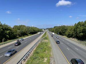
I-95 SB from MD 316 overpass.jpeg
٤٬٠٣٢ × ٣٬٠٢٤؛ ٣٫٣٧ ميجابايت
٤٬٠٣٢ × ٣٬٠٢٤؛ ٣٫٣٧ ميجابايت
١ مراجع
Imported from Wikidata item الإنجليزية
coordinate location الإنجليزية
BabelNet ID الإنجليزية
وصلات الموقع
Marefa(٠ : لا وصلات)
ويكيبيديا(٢ وصلتان)
- enwiki Interstate 95 in Maryland
- frwiki Interstate 95 (Maryland)
