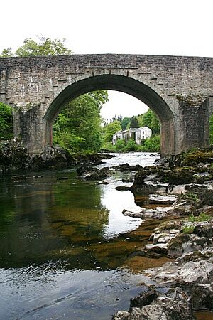
(Q4814699)
بيانات
Wikidata item الإنجليزية
coordinate location الإنجليزية
country الإنجليزية
heritage designation الإنجليزية
category A listed building الإنجليزية
start time الإنجليزية
٣ أغسطس 1971http://data.marefa.org/entity/Q1985727
inventory number الإنجليزية
LB9764
١ مراجع
Imported from Wikidata item الإنجليزية
instance of الإنجليزية
location الإنجليزية
Langholm الإنجليزية
object has role الإنجليزية
Scottish civil parish الإنجليزية
١ مراجع
Imported from Wikidata item الإنجليزية
crosses الإنجليزية
image الإنجليزية
Skipper's Bridge - geograph.org.uk - 1383479.jpg
٤٢٧ × ٦٤٠؛ ٢٤٠ كيلوبايت
٤٢٧ × ٦٤٠؛ ٢٤٠ كيلوبايت
١ مراجع
Imported from Wikidata item الإنجليزية
inception الإنجليزية
historic county الإنجليزية
Google Knowledge Graph ID الإنجليزية
