(Q4780979)
بيانات
Wikidata item الإنجليزية
instance of الإنجليزية
country الإنجليزية
location الإنجليزية
connects with الإنجليزية
Berliner Straße الإنجليزية
coordinate location الإنجليزية
52°37'41.214"N, 13°18'40.259"E
١ مراجع
Imported from Wikidata item الإنجليزية
Niederstraße الإنجليزية
coordinate location الإنجليزية
52°37'44.101"N, 13°18'39.586"E
١ مراجع
Imported from Wikidata item الإنجليزية
Falkenweg الإنجليزية
coordinate location الإنجليزية
52°37'42.427"N, 13°18'39.506"E
١ مراجع
Imported from Wikidata item الإنجليزية
Am Sandkrug الإنجليزية
coordinate location الإنجليزية
52°37'45.178"N, 13°18'38.095"E
١ مراجع
Imported from Wikidata item الإنجليزية
Leipziger Straße الإنجليزية
coordinate location الإنجليزية
52°38'14.316"N, 13°18'21.431"E
١ مراجع
Imported from Wikidata item الإنجليزية
Hauptstraße الإنجليزية
coordinate location الإنجليزية
52°37'50.243"N, 13°18'37.811"E
١ مراجع
Imported from Wikidata item الإنجليزية
Koebisstraße الإنجليزية
coordinate location الإنجليزية
52°37'46.668"N, 13°18'38.290"E
١ مراجع
Imported from Wikidata item الإنجليزية
Nohlstraße الإنجليزية
coordinate location الإنجليزية
52°38'6.486"N, 13°18'27.234"E
١ مراجع
Imported from Wikidata item الإنجليزية
Schönfließer Straße الإنجليزية
coordinate location الإنجليزية
52°37'52.039"N, 13°18'36.932"E
١ مراجع
Imported from Wikidata item الإنجليزية
Oranienburger Chaussee الإنجليزية
coordinate location الإنجليزية
52°38'14.478"N, 13°18'21.319"E
١ مراجع
Imported from Wikidata item الإنجليزية
Lindenstraße الإنجليزية
coordinate location الإنجليزية
52°38'3.368"N, 13°18'29.912"E
١ مراجع
Imported from Wikidata item الإنجليزية
named after الإنجليزية
coordinate location الإنجليزية
postal code الإنجليزية
coordinates of northernmost point الإنجليزية
coordinates of southernmost point الإنجليزية
Commons category الإنجليزية
length الإنجليزية
image الإنجليزية
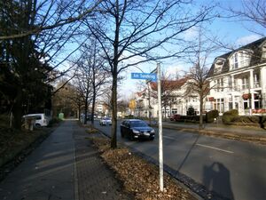
Entenschnabel - Am Sandkrug Ecke Oranienburger Chaussee.jpg
٤٬٢٨٨ × ٣٬٢١٦؛ ٣٫٥٢ ميجابايت
٤٬٢٨٨ × ٣٬٢١٦؛ ٣٫٥٢ ميجابايت
١ مراجع
Imported from Wikidata item الإنجليزية
