(Q4277030)
بيانات
Wikidata item الإنجليزية
Commons category الإنجليزية
instance of الإنجليزية
country الإنجليزية
coordinate location الإنجليزية
named after الإنجليزية
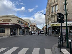
image الإنجليزية
Avenue Jean Jaurès Pavillons Bois 3.jpg
٤٬٠٣٢ × ٣٬٠٢٤؛ ٣٫٦٩ ميجابايت
٤٬٠٣٢ × ٣٬٠٢٤؛ ٣٫٦٩ ميجابايت
١ مراجع
Imported from Wikidata item الإنجليزية
Google Knowledge Graph ID الإنجليزية
OpenStreetMap relation ID الإنجليزية
part of الإنجليزية
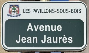
place name sign الإنجليزية
Plaque Avenue Jean Jaurès - Les Pavillons-sous-Bois (FR93) - 2022-03-20 - 1.jpg
٣٬٤١٩ × ٢٬٠٦٢؛ ١٫٣ ميجابايت
٣٬٤١٩ × ٢٬٠٦٢؛ ١٫٣ ميجابايت
١ مراجع
Imported from Wikidata item الإنجليزية
shares border with الإنجليزية
Avenue du Président-Wilson الإنجليزية
coordinate location الإنجليزية
48°54'10.328"N, 2°30'29.938"E
١ مراجع
Imported from Wikidata item الإنجليزية
Avenue Franklin الإنجليزية
coordinate location الإنجليزية
48°54'10.328"N, 2°30'29.938"E
١ مراجع
Imported from Wikidata item الإنجليزية
Avenue Thiers الإنجليزية
coordinate location الإنجليزية
48°54'6.502"N, 2°30'40.000"E
١ مراجع
Imported from Wikidata item الإنجليزية
avenue Thiers الإنجليزية
coordinate location الإنجليزية
48°54'6.502"N, 2°30'40.000"E
١ مراجع
Imported from Wikidata item الإنجليزية
Avenue du Général-Leclerc الإنجليزية
coordinate location الإنجليزية
48°54'29.038"N, 2°29'42.281"E
١ مراجع
Imported from Wikidata item الإنجليزية
Allée Xavier-Privas الإنجليزية
coordinate location الإنجليزية
48°54'25.884"N, 2°29'49.574"E
١ مراجع
Imported from Wikidata item الإنجليزية
Allée Edmond-Richer الإنجليزية
coordinate location الإنجليزية
48°54'27.731"N, 2°29'44.783"E
١ مراجع
Imported from Wikidata item الإنجليزية
Boulevard Louis-Pasteur الإنجليزية
coordinate location الإنجليزية
48°54'6.761"N, 2°30'39.294"E
١ مراجع
Imported from Wikidata item الإنجليزية
Allée Robillard الإنجليزية
coordinate location الإنجليزية
48°54'15.350"N, 2°30'16.974"E
١ مراجع
Imported from Wikidata item الإنجليزية
Allée Pierre-Brossolette الإنجليزية
coordinate location الإنجليزية
48°54'15.350"N, 2°30'16.974"E
١ مراجع
Imported from Wikidata item الإنجليزية
Place de la Résistance الإنجليزية
coordinate location الإنجليزية
48°54'11.138"N, 2°30'27.781"E
١ مراجع
Imported from Wikidata item الإنجليزية
Allée Jean-Baptiste-Clément الإنجليزية
coordinate location الإنجليزية
48°54'20.930"N, 2°30'2.534"E
١ مراجع
Imported from Wikidata item الإنجليزية
Allée Séverine الإنجليزية
coordinate location الإنجليزية
48°54'20.063"N, 2°30'4.763"E
١ مراجع
Imported from Wikidata item الإنجليزية
Allée Arthur-Guérin الإنجليزية
coordinate location الإنجليزية
48°54'19.062"N, 2°30'7.279"E
١ مراجع
Imported from Wikidata item الإنجليزية

