(Q2631865)
بيانات
Wikidata item الإنجليزية
coordinate location الإنجليزية
country الإنجليزية
instance of الإنجليزية
image الإنجليزية
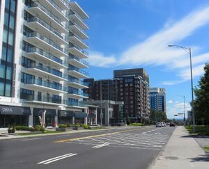
Route de l'Église, Québec 2.jpg
٢٬٧٣٦ × ٢٬٢١٢؛ ٣٫٢١ ميجابايت
٢٬٧٣٦ × ٢٬٢١٢؛ ٣٫٢١ ميجابايت
١ مراجع
Imported from Wikidata item الإنجليزية
Commons category الإنجليزية
connects with الإنجليزية
chemin Sainte-Foy الإنجليزية
Sainte-Foy–Sillery–Cap-Rouge الإنجليزية
coordinate location الإنجليزية
46°46'42.06"N, 71°18'18.11"W
١ مراجع
Imported from Wikidata item الإنجليزية
chemin des Quatre-Bourgeois الإنجليزية
Sainte-Foy–Sillery–Cap-Rouge الإنجليزية
coordinate location الإنجليزية
46°46'27.88"N, 71°17'58.09"W
١ مراجع
Imported from Wikidata item الإنجليزية
boulevard Laurier الإنجليزية
Sainte-Foy–Sillery–Cap-Rouge الإنجليزية
coordinate location الإنجليزية
46°46'1.45"N, 71°17'19.79"W
١ مراجع
Imported from Wikidata item الإنجليزية
chemin Saint-Louis الإنجليزية
Sainte-Foy–Sillery–Cap-Rouge الإنجليزية
coordinate location الإنجليزية
46°45'45.76"N, 71°16'56.50"W
١ مراجع
Imported from Wikidata item الإنجليزية
terminus location الإنجليزية
Cité-Universitaire الإنجليزية
coordinate location الإنجليزية
46°46'42.06"N, 71°18'18.11"W
١ مراجع
Imported from Wikidata item الإنجليزية
Saint-Louis الإنجليزية
coordinate location الإنجليزية
46°45'25.70"N, 71°16'31.98"W
١ مراجع
Imported from Wikidata item الإنجليزية
terminus الإنجليزية
chemin Sainte-Foy الإنجليزية
Sainte-Foy–Sillery–Cap-Rouge الإنجليزية
coordinate location الإنجليزية
46°46'42.06"N, 71°18'18.11"W
١ مراجع
Imported from Wikidata item الإنجليزية
Saint-Louis الإنجليزية
Sainte-Foy–Sillery–Cap-Rouge الإنجليزية
coordinate location الإنجليزية
46°45'25.70"N, 71°16'31.98"W
١ مراجع
Imported from Wikidata item الإنجليزية
Google Knowledge Graph ID الإنجليزية
